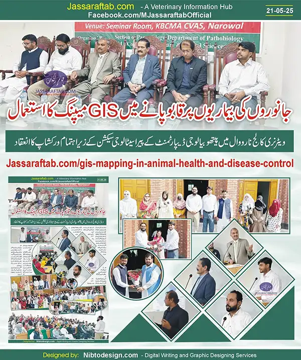
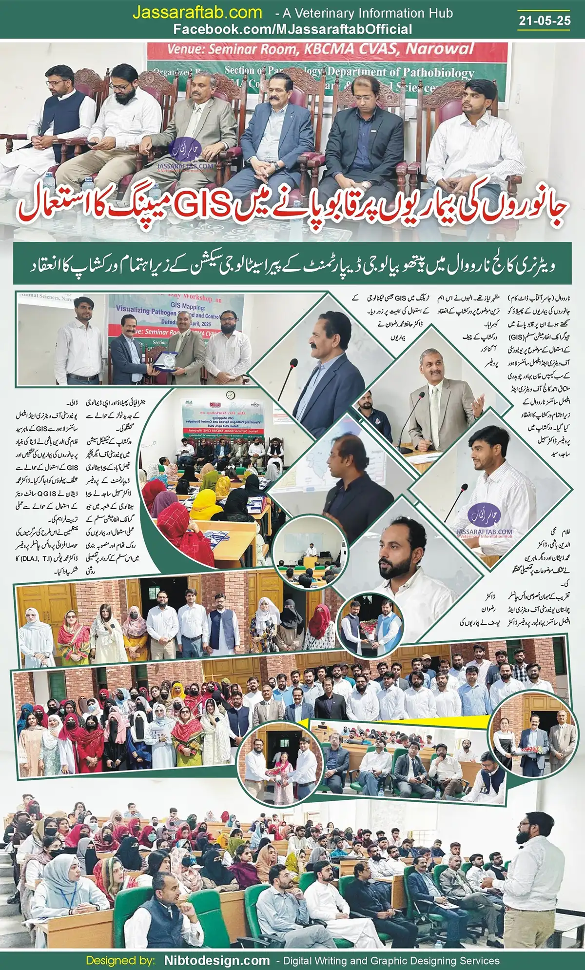
GIS Mapping in Animal Health – Workshop held at KBCMA CVAS Narowal
Khan Bahadur Chaudhry Mushtaq Ahmed College of Veterinary and Animal Sciences, Narowal, a sub-campus of the University of Veterinary and Animal Sciences, Lahore, organized a workshop on GIS Mapping: Visualizing Pathogen Spread and Control Strategies. The workshop focused on the use of Geographic Information Systems (GIS) to understand and control the spread of animal diseases. Besides GIS mapping in Animal Health and the use of GIS for animal disease control, experts also trained the participants on the QGIS Software.
Experts at Workshop on GIS for Animal Diseases Control
In the workshop, Professor Dr. Sohail Sajid, Syed Ghulam Mohiuddin Hashmi, Dr. Muhammad Zeeshan and other experts discussed various topics in detail.
The chief guest of the event was Vice Chancellor Cholistan University of Veterinary and Animal Sciences, Bahawalpur, Professor Dr. Mazhar Ayaz.
The chief convener of the workshop, Professor Dr. Muhammad Rizwan Yousaf, emphasized the importance of using technology like GIS for animal disease control and disease tracking. Dr. Hafiz Muhammad Rizwan discussed the geographical spread of diseases and modern tools of epidemiology.
In the technical session of the workshop, Professor Dr. Sohail Sajid, Department of Parasitology, University of Agriculture Faisalabad, shed detailed light on the practical use of Geographic Information System in the field of Parasitology and its role in disease prevention and planning.
Syed Ghulam Mohiuddin Hashmi, GIS expert from the University of Veterinary and Animal Sciences, Lahore, highlighted various aspects related to data-based diagnosis of animal diseases and use of GIS. Dr. Muhammad Zeeshan provided practical training on the use of QGIS software.
The organizers thanked Vice Chancellor Prof. Dr. Muhammad Younis (DLA.I, T.I) for encouraging such activities.
Understanding GIS Mapping in Animal Health
GIS mapping involves collecting and analyzing spatial data to understand the distribution patterns of diseases in animals. It provides a geographical overview of where outbreaks are occurring, how they are spreading, and what environmental or man-made factors may be contributing to their transmission. With GIS, animal health authorities can layer multiple datasets, like livestock density, movement routes, water sources, and weather patterns, over a digital map. This allows them to identify hotspots of infection, assess risk zones, and monitor the effectiveness of interventions in real-time. GIS for animal disease control has been widely used in various countries, enabling targeted quarantine and vaccination strategies rather than mass, generalized responses.
Role of GIS Mapping in Animal Health and Disease Control
GIS in Disease Surveillance
GIS improves animal disease surveillance by identifying infection hotspots, tracking transmission routes, and predicting high-risk areas. This helps in early detection and enables quick, targeted responses. Diseases like Avian Influenza, Foot-and-Mouth Disease, PPR, and other diseases can be better managed through GIS-based monitoring.
Smart Quarantine and Vaccination Strategies
During an outbreak, GIS helps design efficient control zones, focusing quarantine and vaccination efforts where they’re most needed. Instead of blanket responses, veterinary teams can implement ring vaccination or movement restrictions based on accurate spatial data.
Data-Driven Long-Term Planning
GIS mapping is not just for emergencies. It plays a key role in long-term animal health planning by analyzing historical data, identifying recurring risk zones, and helping governments allocate veterinary resources strategically. This makes disease control more proactive and cost-effective.
GIS Mapping in Animal Health and Importance in the Livestock
GIS mapping empowers farmers, veterinarians, and policymakers with clear, actionable insights. It improves decision-making, supports trade by providing disease-free zones, and helps prevent zoonotic disease spread. As digital tools evolve, GIS for animal disease control will continue to strengthen global animal health systems.
GIS mapping is transforming animal disease control by turning data into action. Its ability to visualize outbreaks, enhance surveillance, and support strategic planning makes it an essential technology for modern veterinary health management.
QGIS Software
QGIS (Quantum GIS) is a free, open-source Geographic Information System (GIS) software that allows users to create, edit, analyze, and visualize geospatial data. It is one of the most popular GIS platforms globally and is widely used in fields like environmental science, urban planning, disaster management, agriculture, and veterinary epidemiology.
in veterinary science and livestock disease control, QGIS Software is used to map outbreaks, track disease spread, and design intervention strategies. For example, during an outbreak of Foot-and-Mouth Disease, veterinary teams can use QGIS to visualize infected zones, set up buffer areas, and analyze animal movement routes to prevent further spread.







2 Comments
I couldn’t turn down commenting. Warmly written! endep medication
This is the gentle of criticism I rightly appreciate.